Atlas

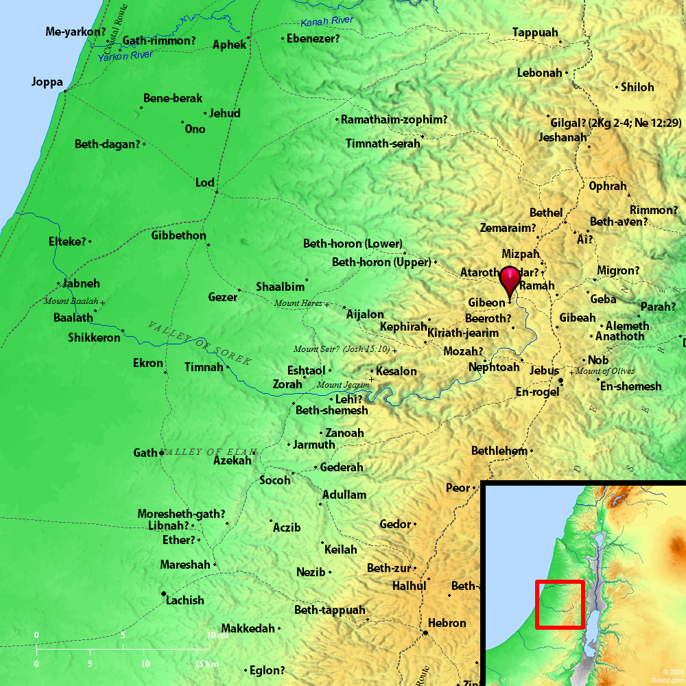
Geba 2 (Gibeon) and surrounding region
Maps Created using Biblemapper 3.0Additional data from OpenBible.info
You are free to use up to 50 Biblos coprighted maps (small or large) for your website or presentation. Please credit Biblos.com.
Occurrences
2 Samuel 5:25 David did so, as Yahweh commanded him, and struck the Philistines from Geba until you come to Gezer.
Encyclopedia
GEBAge'-ba (gebha`, "hill"):
(1) A town on the Northeast boundary of the territory of Benjamin (Joshua 18:24), given to the Levites (Joshua 21:17 1 Chronicles 6:60). It stood on the northern frontier of the kingdom of Judah, Geba and Beersheba marking respectively the northern and southern limits (2 Kings 23:8). In 2 Samuel 5:25 "Geba" should be altered to "Gibeon," which stands in the corresponding passage, 1 Chronicles 14:16. In Judges 20:10, 33 1 Samuel 13:3, 16, the Hebrew reads "Geba," the translation "Gibeah" being due to confusion of the two names. From 1 Samuel 14:5 we gather that Geba stood to the South of the great gorge, Wady Suweinit, commanding the pass at Michmash. This was the scene of Jonathan's daring enterprise against the Philistines, when, accompanied by his armor-bearer, he accomplished an apparently impossible feat, climbing the rocky steeps of the gorge to the North and putting the enemy to flight. There can be no doubt that the modern village of Jeba` occupies the ancient site. It stands to the South of Wady Suweinit, looking toward Michmash-modern Mukhmas-with Seneh, the crag on the southern lip of the gorge, in front of it. The distance from Jerusalem is about 6 miles. It was fortified by Asa with materials that his enemy Baasha had used to fortify Ramah against him (1 Kings 15:22). It is named by Isaiah in his description of the terrifying march of the Assyrians upon Jerusalem from the North (10:28). It appears among the cities which were reoccupied by Israel after the Exile (Ezra 2:26 Nehemiah 11:31).
(2) (Gaibai): Between a fortress so named and Scythopolis (Beisan), Holofernes pitched his camp (Judith 3:10). On the high road that runs through Jenin, and down the Vale of Jezreel to Beisan, about 2 miles to the South of Sanur, stands the village of Jeba`, with which this fortress may be identified.
W. Ewing


