Encyclopedia
MELITAmel'-i-ta (Melite, Acts 28:1): Is now generally identified with Malta. The former error in attributing the reference to the island of Meleda on the East coast of the Adriatic Sea was due to the ancient practice of employing the term Adria to include the Ionian and Sicilian seas.
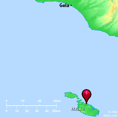
Malta is the largest of a group of islands including Gozo and the islets Comino, Cominotto and Filfla, lying about 56 miles from the southern extremity of Sicily, 174 from the mainland of Italy, and 187 from the African coast. Malta itself is 17 1/2 miles long and 9 1/4 broad, and contains an area of 95 square miles. Its modern capital, Valetta, is situated in 35 degrees 54' North latitude and 14 degrees 31' East longitude.
The central position of Malta in the Mediterranean Sea gave it great importance as a naval station. It was probably at first a Phoenician colony, and later passed under the influence, if not domination, of the Sicilian Greeks. But the Romans captured it from the Carthaginians in 218 B.C. (Livy xxi.51) and attached it definitely to the province of Sicily. Under Roman rule the inhabitants were famous for their industry, especially in the production of textile fabrics, probably of native cotton. The celebrated vestis melitensis was a fine and soft material for dresses and for the covering of couches (Cicero Verr. ii.72, 176; ii.74, 183; iv.46, 103; Diodorus v.12, 22). At the time when Paul visited the island it would seem that the administration was entrusted to a deputy of the proprietor of Sicily, who is referred to as protos Melitaion (Acts 28:7; CIG, 5754), or Melitensium primus omnium (CIL, x, 7495) (see PUBLIUS). A bay 2 1/2 miles Northwest of Valetta, the mouth of which is held by tradition to be the place where the vessel that bore Paul ran ashore, tallies admirably with the description of the locality in Acts. The Admiralty charts indicate places near the west side of the entrance to the bay, where the depth is first 20 ft. and then 15 ft., while the rush of the breakers in front of the little island of Salmoneta and behind it suit the reference to a place "where two seas met" (Acts 27:41). The inlet is called the Bay of Paul. The topographical question has been exhaustively treated by Ramsay in Paul the Traveler.
George H. Allen
MEL'ITA, now Malta, an island in the Mediterranean, 60 ms. s. of Sicily, 155 ms. from the nearest point of Italy and 185 from nearest point in Africa. Greatest width 12 and length 20 ms.; circumference 60 ms.; it is farther distant from the main land than is any other island in the Mediterranean. On the s. coast it is almost impossible to land because of the steep rocks. The bay called St. Paul's bay is on the n. coast of the island.
Strong's Greek
G3194: MelitMelita (Malta), an island in the Mediterranean