Encyclopedia
SYRIA (1)sir'-i-a (Suria (Matthew 4:24 Luke 2:2)):
1. Name and Its Origin
2. Other Designations
3. Physical
(1) The Maritime Plain
(2) First MoUntain Belt
(3) Second Mountain Belt
(4) Great Central Valley
(5) The Eastern Belt
(6) Rivers
(7) Nature of Soil
(8) Flora
(9) Fauna
(10) Minerals
(11) Central Position
4. History
(1) Canaanitic Semites
(2) Sargon of Agade
(3) Babylonian Supremacy
(4) Hittite and Aramean
(5) Hittites and Egyptians
(6) Amarna Period
(7) Rameses II
(8) Philistines
(9) Tiglath-pileser I
(10) Aramean States
(11) Peaceful Development
(12) Shalmaneser II
(13) Tiglath-pileser III
(14) Shalmaneser IV and Sargon
(15) Pharaoh-necoh and Nebuchadnezzar
1. Name and Its Origin:
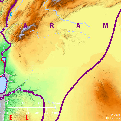
The name does not occur in the Massoretic Text nor the Peshitta of the Old Testament, but is found in the Septuagint, in the Peshitta of the New Testament and in the Mishna In the Septuagint it represents "Aram" in all its combinations, as Aram-zobah, etc. The name itself first appears in Herodotus vii.63, where he says that "Syrians" and "Assyrians" were the Greek and barbarian designations of the same people. Otherwise he is quite vague in his use of the term. Xenophon is clearer when he (Anab; vii.8, 25) distinguishes between Syria and Phoenicia. Syria is undoubtedly an extension of the name "Suri" the ancient Babylonian designation of a district in North Mesopotamia, but later embracing regions beyond the Euphrates to the North and West, as far as the Taurus. Under the Seleucids, Syria was regarded as coextensive with their kingdom, and the name shrank with its dimensions. Strabo, Pliny and Ptolemy give its boundaries as the Taurus Mountains, the Euphrates, the Syro-Arabian desert and the Mediterranean, and the territory within these limits is still politically designated Syria, though popularly Palestine is generally named separately.
2. Other Designations:
Homer (Iliad ii.785) and Hesiod (Theog. 304) call the inhabitants of the district "Arimoi," with which compare the cuneiform "Arimu" or "Aramu" for Arameans. The earliest Assyrian name was "Martu," which Hommel regards as a contraction of "Amartu," the land of the "Amurru" or Amorites. In Egyptian records the country is named "Ruten" or "Luten," and divided into "Lower" and "Upper," the former denoting Palestine and the latter Syria proper.
3. Physical:
(1) The Maritime Plain.
Syria, within the boundaries given, consists of a series of belts of low and high land running North and South, parallel to the Mediterranean. The first of these is the maritime plain. It consists of a broad strip of sand dunes covered by short grass and low bushes, followed by a series of low undulating hills and wide valleys which gradually rise to a height of about 500 ft. This belt begins in North Syria with the narrow Plain of Issus, which extends to a few miles South of Alxandretta, but farther South almost disappears, being represented only by the broader valleys and the smaller plains occupied by such towns as Latakia, Tripolis and Beirut. South of the last named the maritime belt is continuous, being interrupted only where the Ladder of Tyre and Mt. Carmel descend abruptly into the sea. In the Plain of Akka it has a breadth of 8 miles, and from Carmel southward it again broadens out, till beyond Caesarea it has an average of 10 miles. Within the sand dunes the soil is a rich alluvium and readily yields to cultivation. In ancient times it was covered with palm trees, which, being thence introduced into Greece, were from their place of origin named phoinikes.
(2) First Mountain Belt.
From the maritime plain we rise to the first mountain belt. It begins with the Amanus, a branch of the Taurus in the North. Under that name it ceases with the Orontes valley, but is continued in the Nuseiriyeh range (Mt. Cassius, 5,750 ft.), till the Eleutherus valley is reached, and thence rising again in Lebanon (average 5,000 ft.), Jebel Sunnin (8, 780 ft.), it continues to the Leontes or Quasmiyeh. The range then breaks down into the rounded hills of Upper Galilee (3, 500 ft.), extends through the table-land of Western Palestine (2, 500 ft.), and in the South of Judea broadens out into the arid Badiet et-Tih or Wilderness of Wandering.
(3) Second Mountain Belt.
Along with this may be considered the parallel mountain range. Beginning in the neighborhood of Riblah, the chain of anti-Lebanon extends southward to Hermon (9, 200 ft.), and thence stretches out into the plateau of the Jaulan and Hauran, where we meet with the truncated cones of extinct volcanoes and great sheets of basaltic lava, especially in el-Leja and Jebel ed-Druz. The same table-land continues southward, with deep ravines piercing its sides, over Gilead, Moab and Edom.
(4) Great Central Valley.
Between Lebanon and Anti-Lebanon lies the great valley of Coele-Syria. It is continued northward along the Orontes and thence stretches away eastward to the Euphrates, while southward it merges into the valleys of the Jordan and the Arabah. From the sources of the Orontes and Leontes at Baalbek (4,000 ft.) it falls away gently to the North; but to the South the descent is rapid. In Merj `Ayun it has sunk to 1,800 ft., at Lake Huleh it is over 7 ft., at the Lake of Tiberias-682 ft., and at the Dead Sea-1, 292 ft., and thence it rises again to the Gulf of Akabah. This great valley was caused by a line of fault or fracture of the earth's crust, with parallel and branching faults. In ancient times the whole valley formed an arm of the sea, and till the Glacial period at the end of the Tertiary (Pleistocene) Age, a lake extended along the whole Jordan valley as far as the Huleh. We can thus understand that the great plain and adjoining valleys consist mainly of alluvial deposits with terraces of gravel and sand on the enclosing slopes.
See LEBANON; NATURAL FEATURES; PALESTINE; PHOENICIA.
(5) The Eastern Belt.
To the East of the Anti-Lebanon belt there is a narrow stretch of cultivated land which in some places attains a breadth of several miles, but this is always determined by the distance to which the eastern streams from Anti-Lebanon flow. Around Damascus the Abana (Barada) and neighboring streams have made the district an earthly paradise, but they soon lose themselves in the salt marshes about 10 miles East of the city. Elsewhere the fruitful strip gradually falls away into the sands and rocks of the Syrian desert, barren alike of vegetable and animal life.
(6) Rivers.
The mountain ranges determine the course of the rivers and their length. The streams flowing westward are naturally short and little more than summer torrents. Those flowing to the desert are of the same character, the only one of importance being the Abana, to which Damascus owes its existence. Only the great central valley permits the formation of larger rivers, and there we find the Orontes and Leontes rising within a few feet of each other beside Baalbek, and draining Coele-Syria to the North and South, till breaking through the mountains they reach the sea. The Jordan is the only other stream of any size. In ancient, as also in modern times, the direction of these streams determined the direction of the great trade route from Mesopotamia to Egypt through Coele-Syria and across pal, as also the position of the larger towns, but, not being themselves navigable, they did not form a means of internal communication.
(7) Nature of Soil.
The variation in altitude both above and below the sea-level is naturally conducive to a great variety of climate, while the nature of the disintegrating rocks and the alluvial soil render great productivity possible. Both of the mountain belts in their whole length consist chiefly of cretaceous limestone, mixed with friable limestone with basaltic intrusions and volcanic products. The limestone is highly porous, and during the rainy season absorbs the moisture which forms reservoirs and feeds the numerous springs on both the eastern and western slopes. The rocks too are soft and penetrable and can easily be turned into orchard land, a fact that explains how much that now appears as barren wastes was productive in ancient times as gardens and fruitful fields (Bab Talmud, Megh. 6a).
(8) Flora.
The western valleys and the maritime plain have the flora of the Mediterranean, but the eastern slopes and the valleys facing the desert are poorer. On the southern coasts and in the deeper valleys the vegetation is tropical, and there we meet with the date-palm, the sugar-cane and the sycomore. Up to 1,600 ft., the products include the carob and the pine, after which the vine, the fig and the olive are met with amid great plantations of dwarf oak, till after 3,000 ft. is reached, then cypresses and cedars till the height of 6,200 ft., after which only Alpine plants are found. The once renowned "cedars of Lebanon" now exist only in the Qadisha and Baruk valleys. The walnut and mulberry are plentiful everywhere, and wheat, corn, barley, maize and lentils are widely cultivated. Pasture lands are to be found in the valleys and plains, and even during the dry season sheep, goats and cattle can glean sufficient pasturage among the low brushwood.
(9) Fauna.
The animal world is almost as varied. The fox, jackal, hyena, bear, wolf and hog are met nearly everywhere, and small tigers are sometimes seen (compare 2 Kings 14:9). The eagle, vulture, partridge and blue pigeon are plentiful, and gay birds chirp everywhere. The fish in the Jordan and its lakes are peculiar and interesting. There are in all 22 varieties, the largest being a kind of perch, the coracinus, which is known elsewhere also in the Nile (Josephus, Ant, III, x, 8), and a peculiar old-world variety locally named `Abu-musht.
(10) Minerals.
In both the eastern and the western mountain belts there are abundant supplies of mineral wealth. They consist chiefly of coal, iron, bitumen, asphalt and mineral oil, but they are mostly unworked. In the Jordan valley all the springs below the level of the Mediterranean are brackish, and many of them are also hot and sulfurous, the best known being those Tiberias.
(11) Central Position.
The country, being in virtue of its geographical configuration separated into small isolated districts, naturally tended to break up into a series of petty independent states. Still the central position between the Mesopotamian empires on the one hand and Egypt and Arabia on the other made it the highway through which the trade of the ancient world passed, gave it an importance far in excess of its size or productivity, and made it a subject of contention whenever East and West were ruled by different powers.
4. History:
(1) Canaanitic Semites.
When history begins for us in the 3rd millennium B.C., Syria was already occupied by a Semitic population belonging to the Canaanitic wave of immigration, i.e. such as spoke dialects akin to Hebrew or Phoenician. The Semites had been already settled for a considerable time, for a millennium earlier in Egypt we find Semitic names for Syrian articles of commerce as well as Semites depicted on the Egyptian monuments.
(2) Sargon of Agade.
Omitting as doubtful references to earlier relations between Babylonia and Syria, we may consider ourselves on solid ground in accepting the statements of the Omen Tablets which tell us that Sargon of Agade (2750 B.C.) four times visited the land of Martu and made the peoples of one accord. His son Naram-sin, while extending the empire in other directions maintained his authority here also. Commercial relations were continued, and Babylonia claimed at least a supremacy over Martu, and at times made it effective.
(3) Babylonian Supremacy.
Hammurabi and also his great-grandson Ammisatana designate themselves in inscriptions as kings of Martu, and it is very likely that other kings maintained the traditional limits of the empire. The long-continued supremacy of Babylon not only made itself felt in imposing place-names, but it made Assyrian the language of diplomacy, even between Syria and Egypt, as we see in the Tell el-Amarna Letters.
(4) Hittite and Aramean.
By the middle of the 2nd millennium B.C. we find considerable change in the population. The Mitanni, a Hittite people, the remains of whose language are to be found in the still undeciphered inscriptions at Carchemish, Marash, Aleppo and Hamath, are now masters of North Syria.
See HITTITES.
The great discoveries of Dr. H. Winckler at Boghazkeui have furnished a most important contribution to our knowledge. The preliminary account may be found in OLZ, December 15, 1906, and the Mitteilungen der deutschen orient. Gesellschaft, number 35, December, 1907.
Elsewhere the Aramean wave has become the predominant Semitic element of population, the Canaanitic now occupying the coast towns (Phoenicians) and the Canaan of the Old Testament.
(5) Hittites and Egyptians.
At this time Babylonia was subject to the Kassites, an alien race of kings, and when they fell, about 1100 B.C., they gave place to a number of dynasties of short duration. This gave the Egyptians, freed from the Hyksos rule, the opportunity to lay claim to Syria, and accordingly we find the struggle to be between the Hittites and the Egyptians. Thothmes I, about 1600 B.C.a overran Syria as far as the Euphrates and brought the country into subjection. Thothmes III did the same, and he has left us on the walls of Karnak an account of his campaigns and a list of the towns he conquered.
(6) Amarna Period.
In the reign of Thothmes IV the Hittites began to leave their mountains more and more and to press forward into Central Syria. The Tell el-Amarna Letters show them to be the most serious opponents to the Egyptian authority in Syria and Palestine during the reign of Amenhotep IV (circa 1380 B.C.), and before Seti I came to the throne the power of the Pharaohs had greatly diminished in Syria. Then the Egyptian sphere only reached to Carmel, while a neutral zone extended thence to Kadesh, northward of which all belonged to the Hitites.
(7) Rameses II.
Rameses II entered energetically into the war against Hatesar, king of the Hittites, and fought a battle near Kadesh. He claims a great victory, but the only result seems to have been that his authority was further extended into the neutral territory, and the sphere of Egyptian influence extended across Syria from the Lycus (Dog River) to the South of Damascus. The arrangement was confirmed by a treaty in which North Syria was formally recognized as the Hittite sphere of influence, and, on the part of the Assyrians who were soon to become the heirs of the Hittite pretensions, this treaty formed the basis of a claim against Egypt. About the year 1200 B.C. the Hittites, weakened by this war, were further encroached upon by the movements of northern races, and the empire broke up into a number of small separate independent states.
(8) Philistines.
Among the moving races that helped to weaken and break up the Hittite influence in Syria were the Pulusati (or Purusati), a people whose origin is not yet definitely settled. They entered Syria from the North and overcame all who met them, after which they encamped within the Egyptian sphere of influence. Rameses III marched against them, and he claims a great victory. Later, however, we find them settled in Southeastern Palestine under the name of Philistines. Their settlement at that time is in harmony with the Tell el-Amarna Letters in which we find no trace of them, while in the 11th century B.C. they are there as the inveterate foes of Israel.
(9) Tiglath-pileser I.
Assyria was now slowly rising into power, but it had to settle with Babylon before it could do much in the West. Tiglath-pieser I, however, crossed the Euphrates, defeated the Hittite king of Carchemish, advanced to the coast of Arvad, hunted wild bulls in Lebanon and received gifts from the Pharaoh, who thus recognized him as the successor of the Hittites in North Syria.
(10) Aramean States.
When the Hittite empire broke up, the Arameans in Central Syria, now liberated, set up a number of separate Aramean states, which engaged in war with one another, except when they had to combine against a common enemy. Such states were established in Hamath, Hadrach, Zobah and Rehob. The exact position of Hadrach is still unknown, but Hamath was evidently met on its southern border by Rehob and Zobah, the former extending along the Biqa'a to the foot of Hermon, while the latter stretched along the eastern slopes of Anti-Lebanon and included Damascus, till Rezon broke away and there set up an independent kingdom, which soon rose to be the leading state; Southeast of Hermon were the two smaller Aramean states of Geshur and Maacah.
(11) Peaceful Development.
For nearly three centuries now, Syria and Palestine were, except on rare occasions, left in peace by both Mesopotamia and Egypt. In the 12th century B.C. Babylonia was wasted by the Elamite invasion, and thereafter a prolonged war was carried on between Assyria and Babylonia, and although a lengthened period of peace succeeded, it was wisely used by the peaceful rulers of Assyria for the strengthening of their kingdom internally. In Egypt the successors of Rameses III were engaged against the aggressive Theban hierarchy. During the XXIst Dynasty the throne was usurped by the high priests of Amen, while the XXIId were Lybian usurpers, and the three following dynasties Ethiopian conquerors.
(12) Shalmaneser II.
In the 9th century Asshur-nazirpal crossed the Euphrates and overran the recently established state of Patin in the Plain of Antioch. He besieged its capital and planted a colony in its territory, but the arrangement was not final, for his successor, Shalmaneser II, had again to invade the territory and break up the kingdom into a number of small principalities. Then in 854 B.C. he advanced into Central Syria, but was met at Karkar by a strong confederacy consisting of Ben-hadad of Damascus and his Syrian allies including Ahab of Israel. He claims a victory, but made no advance for 5 years. He then made three unsuccessful expeditions against Damascus, but in 842 received tribute from Tyre, Sidon and Jehu of Israel, as recorded and depicted on the Black Obelisk. It was not till the year 797 that Ramman-nirari, after subduing the coast of Phoenicia, was able to reduce Mari'a of Damascus to obedience at which time also he seems to have carried his conquests through Eastern Palestine as far as Edom. The Assyrian power now suffered a period of decline, during which risings took place at Hadrach and Damascus, and Jeroboam II of Israel was able (2 Kings 14:25) to extend his boundaries northward to the old limits.
(13) Tiglath-pileser III.
It thus happened that Tiglath-pileser III (745-728) had to reconquer the whole of Syria. He captured Arpad after two years' warfare (742-740). Then he divided the territory of Hamath among his generals. At this juncture Ahaz of Judah implored his aid against Rezin of Damascus and Remaliah of Israel. Ahaz was relieved, but was made subject to Assyria. Damascus fell in 732 B.C. and a Great Court was held there, which the tributary princes of Syria, including Ahaz (2 Kings 16:10), attended. The Assyrian empire now possessed the whole of Syria as far as the River of Egypt. Sibahe, however, encouraged revolt in what had been the Egyptian sphere of infiuence and insurrections took place in Phoenicia and Samaria.
(14) Shalmaneser IV and Sargon.
After some difficulty Shalmaneser IV compelled Tyre and Sidon to submit and to pay tribute. Samaria, too, was besieged, but was not taken till Sargon came to the throne in 722. Hamath and Carchemish again rose, but were finally reduced in 720 and 717 respectively. Again in 711 Sargon overran Palestine and broke up a fresh confederacy consisting of Egypt, Moab, Edom, Judah and the Philistines. In 705 the Egyptians under Sibahe and their allies the Philistines under Hanun of Gaza were defeated at Raphia.
The last three rulers of Assyria were in constant difficulties with Babylonia and a great part of the empire was also overrun by the Scythians (circa 626 B.C.), and so nothing further was done in the West save the annexation of the mainland possessions of Phoenicia.
(15) Pharaoh-necoh and Nebuchadnezzar.
In 609 when Assyria was in the death grapple with Babylonia, Pharaoh-necoh took advantage of the situation, invaded Syria, and, defeating Josiah en route, marched to Carchemish. In 605, however, he was there completely defeated by Nebuchadnezzar, and the whole of Syria became tributary to Babylonia. the former Syrian states now appear as Babylonian provinces, and revolts in Judah reduced it also to that position in 586 B.C.
Under Persian rule these provinces remained as they were for a time, but ultimately "Ebir nari" or Syria was formed into a satrapy. The Greek conquest with the Ptolemies in Egypt and the Seleucids in Babylon brought back some of the old rivalry between East and West, and the same unsettled conditions. On the advent of Rome, Syria was separated from Babylonia and made into a province with Antioch as its capital, and then the Semitic civilization which had continued practically untouched till the beginning of the Christian era was brought more and more into contact with the West. With the advent of Islam, Syria fell into Arab hands and Damascus became for a short time (661-750 A.D.) the capital of the new empire, but the central authority was soon removed to Babylonia. Thenceforward Syria sank to the level of a province of the caliphate, first Abbasside (750-1258), then Fatimite (1258-1517), and finally Ottoman.
W. M. Christie