Atlas 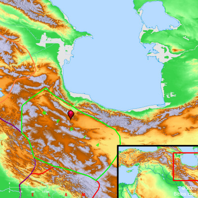 Media and surrounding region Maps Created using Biblemapper 3.0 Additional data from OpenBible.info You are free to use up to 50 Biblos coprighted maps (small or large) for your website or presentation. Please credit Biblos.com. Occurrences Ezra 6:2 There was found at Achmetha, in the palace that is in the province of Media, a scroll, and therein was thus written for a record:Esther 1:3 in the third year of his reign, he made a feast for all his princes and his servants; the power of Persia and Media, the nobles and princes of the provinces, being before him. Esther 1:14 and the next to him were Carshena, Shethar, Admatha, Tarshish, Meres, Marsena, and Memucan, the seven princes of Persia and Media, who saw the king's face, and sat first in the kingdom), Esther 1:18 Today, the princesses of Persia and Media who have heard of the queen's deed will tell all the king's princes. This will cause much contempt and wrath. Esther 10:2 All the acts of his power and of his might, and the full account of the greatness of Mordecai, to which the king advanced him, aren't they written in the book of the chronicles of the kings of Media and Persia? Isaiah 21:2 A grievous vision is declared to me. The treacherous man deals treacherously, and the destroyer destroys. Go up, Elam; attack! I have stopped all of Media's sighing. Jeremiah 25:25 and all the kings of Zimri, and all the kings of Elam, and all the kings of the Medes; Daniel 8:20 The ram which you saw, that had the two horns, they are the kings of Media and Persia. Encyclopedia MEDIAme'-di-a (madhay; Achaem. Persian Mada; Media): Lay to the West and Southwest of the Caspian, and extended thence to the Zagrus Mountains on the West On the North in later times it was bounded by the rivers Araxes and Cyrus, which separated it from Armenia. Its eastern boundaries were formed by Hyrcania and the Great Salt Desert (now called the Kavir), and it was bounded on the South by Susiana. In earlier times its limits were somewhat indefinite. It included Atropatene, (Armenian Atrpatakan, the name, "Fire-guarding," showing devotion to the worship of Fire) to the North, and Media Magna to the South, the former being the present A'zarbaijan. Near the Caspian the country is low, damp and unhealthy, but inland most of it is high and mountainous, Mt. Demavand in the Alburz range reaching 18,600 ft. Atropatene was famed for the fertility of its valleys and table-lands, except toward the North. Media Magna is high; it has fruitful tracts along the course of the streams, but suffers much from want of water, though this was doubtless more abundant in antiquity. It contained the Nisaean Plain, famous for its breed of horses. The chief cities of ancient Media were Ecbatana, Gazaea, and Ragae. The Orontes range near Ecbatana is the present Alvand. Lake Spauta is now known as Urmi (Urumiah). MEDIA, was bounded on the n.e. by the Caspian Sea; n. by the Araxes river; e. by Parthia and Hyrcania; on the s. by Persia and Susiana; on the w. by Assyria and Armenia. Its greatest length was 550 ms. n. and s. and width about 250 ms. e. and w. It is now included in Persia. It was exceedingly mountainous and wooded and was 700 ms. e.n.e. from Jerusalem. Strong's Hebrew H4074: Madaya son of Japheth, also his desc. and their land |
    |