Atlas 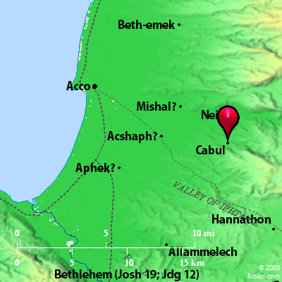 Cabul and surrounding area Maps Created using Biblemapper 3.0 Additional data from OpenBible.info You are free to use up to 50 Biblos coprighted maps (small or large) for your website or presentation. Please credit Biblos.com. Occurrences Joshua 19:27 It turned toward the sunrise to Beth Dagon, and reached to Zebulun, and to the valley of Iphtah El northward to Beth Emek and Neiel. It went out to Cabul on the left hand,Encyclopedia CABULka'-bul (kabhul; Codex Vaticanus, Chobamasomel; Codex Alexandrinus, Chabol apo aristeron): CA'BUL, now a small hamlet called Kabul, 9 ms. s. e. of Accho and 74 ms. n. of Jerusalem. Strong's Hebrew H3521: Kabula city in Asher, also a region in Galilee |
    |